 BGS Data Catalogue
Remote sensing
Type of resources
Topics
Keywords
Contact for the resource
Provided by
Years
Formats
Representation types
Update frequencies
Scale
-

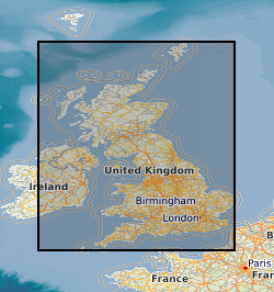
**This dataset has been withdrawn and is no longer avaible from BGS** The database contains satellite images of the UK purchased by the BGS or on its behalf by NERC. It includes data from the Lansdat, SPOT, Radarsat and ERS satellites. The images are stored in proprietary format on various types of magnetic media. The data are currently stored by path-row scene numbers and as mosaics on tapes, CDs and drives. Entire UK is covered by the dataset, however, there are gaps in coverage from individual sensors. Coverage exists for countries (or parts of countries) where work has been carried out.
-

Index to various collections of Aerial Photographs purchased or obtained by BGS and its precursors as part of its surveying activities. The index was set up in 2000 and mainly covers Great Britain. The level of spatial detail depends on the flight plans provided, but most are referenced at least to OS quarter sheet level.
-
Collections of Aerial Photographs purchased or obtained by BGS and its precursors as part of its surveying activities. Data covers mainly Great Britain or areas where BGS has worked overseas and dates from the 1940's. The collection is incomplete and there are copyright and other constraints on its use.
-
The database contains scanned photographs (at 1016dpi) of the UK and various locations around the world. Some are single band (black&white) others are 3 band colour. The images are stored in various formats on various types of magnetic media: .COT raw scans can only be used on the Intergraph ImageStation; .JPG (Intergraph format); .TIF. Processed scans may also be saved as stereomodels (with project data) and as orthophotographs. Mono coverage for most of the UK and we are constantly acquiring stereo data. Data is updated when unscanned areas are required by projects.